| Road Trip to California and Los Angeles |
Road Trip to California and Los Angeles
I visited friends in the area around Los Angeles and Ventura County in March 2000. Call this a road trip report, an air trip report, and a report on the Los Angeles area. This will also be an interesting perspective from an easterner who in over 4 decades of life just made his first trip to California, and was introduced to California via the Los Angeles area. Quite frankly it was a fascinating trip, and my perceptions were a bit unexpected given the amount of negative press that some people in the East give to the state and L.A. area in particular (allegations of too many people, too much smog, too much traffic, area too liberal, etc.).
Obviously my visit to Los Angeles city and county and to Ventura County was to just one part of California; there are many other notable places I haven't been to, such as the metro areas of San Diego, San Francisco; and places like Yosemite, Lake Tahoe, Monterey, Big Sur, the redwood forests, Death Valley and the other deserts, etc.
Los Angeles was very interesting, from the parts that I saw from the plane and from a long road circuit through the area. The smog was no worse than other large eastern metro areas, in other words, very improved over the last 30 years. L.A. is a huge world-class metro area of about 17 million people, with vast amounts of business, heavy industry, one of the largest ports in the world in tonnage shipped, a Navy base, and a large downtown. One of the most interesting things about the area is the fact that the Pacific Ocean and large mountains (the biggest were snowcapped) are right at the edges of the metro area. The traffic was heavy, but I didn't drive in the city during peak hours.
California drivers in the L.A. area are pretty good drivers, with good lane discipline, less high speeding, and not much weaving from lane to lane. Unlike the D.C. area and other Eastern metro areas, where you see a lot of these. They are better out there...
The climate of the area has been described as "Mediterranean"; the temperatures are in the sub-tropical range, but the annual rainfall is 1/4 of most places on the eastern seaboard. Most of the "trees" are actually bushes, and the amount of full-sized trees are perhaps only 5% of central Virginia. Still, things look fairly green, and there are many types of trees and bushes and grasses that are sub-tropical in nature, somewhat like what you see in central Florida.
Ventura County has about 750,000 residents, and there are
huge flat expanses of agricultural areas between large mountain ridges, and the northern half of the county is mostly mountainous. These mountains are in the 3,000 to 9,000 foot elevation range.Road trip:
Easily the most spectacular highway I saw in the L.A. area was the Pacific Coast Highway. It is CA-1 from Santa Monica to Oxnard, and the coast is hilly to mountainous with small beaches in various places. The beach at Malibu near Sunset Blvd. is a large wide beach. I've spent a lot of time around Atlantic coast beaches, and the land is pretty flat there. The Pacific coast in California is much different with its hilly to mountainous terrain. VERY spectacular, and I shot a bunch of photos, and rode it in both directions from Santa Monica to Oxnard. The US-101 freeway from Ventura to Santa Barbara has equally spectacular scenery, and I saw that on a trip to the Santa Barbara Zoo Very nice zoo, too... I also visited the campus of
Pepperdine University, which I considered attending back in the mid-1970s; very nice piece of hilly real estate near the coast in Malibu with a great view!!I rented a Ford F-150 pickup truck for one day (actually 24 hours overlapping 2 days), and I drove about 400 miles. Nice powerful truck and a high seat!! The big day trip avoided peak hours, and was from Oxnard to the CA-1 Pacific Coast Highway, then following the PCH to Santa Monica, then the I-10 Santa Monica Freeway to the downtown, then the I-5 Golden State Freeway all the way north to the I-210 Foothill Freeway, then I-210 to Pasadena and east to east of the I-605 San Gabriel River Freeway, then I-605 to the I-10 San Bernardino Freeway, then I-10 west to the downtown, then looping around the downtown on the freeway loop using CA-110, US-101 and to the I-5 Santa Ana Freeway.
I headed south on I-5, thinking about going to Orange County, but I wanted to be at least back to LAX/I-405 or north by 3:00 PM, since it was Friday and I wanted to be leaving the L.A. area to the north before the peak period started. So I got off I-5 at I-605 so that I could see the I-105 Century Freeway. I stopped and had lunch in Downey. I rode I-105 to LAX, and then back to I-405 to head north. I liked the PCH so much before that I decided that I wanted to see it from the reverse direction, so I left I-405 at I-10 and headed west to the end of I-10 in Santa Monica, and took the PCH all the way back to Oxnard. So I first saw the PHC heading east in the morning, and then heading west in the late afternoon. I took about 40 photos along the whole circuit. Plus I stopped in various places to look around.
Roads:
Pacific Coast Highway: Lots of hills and small mountains along the coast. The highway ranges from about 10 feet above sea level to 400 feet or more above sea level. It is very interesting seeing the ocean from a height, something I had not seen before, since I lived in the East (never been to Maine). Still, the ocean horizon looks just as far away... I saw lots of surfers (looks like they had wetsuits on... bbrrrr!!...) in various places, and that brought back memories of the amount of time that I spent at the Atlantic beaches in central Florida in the 1960s, plus doing some surfing... The Pacific seemed fairly calm the few days that I saw it. There was good surf, but beyond the surf line it was fairly calm and some small craft were out there. Given how huge the Pacific is, I expected it to be rougher, and it seemed calmer than the average Atlantic. The waters are cobalt blue. Anyhow, the PCH was spectacular, with the hills, the curving coastline, and the many expensive houses on the hillsides.
I-10 Santa Monica Freeway: Short 4-lane tunnel about 1/4-mile-long at the west end connecting to the PCH. Most of the freeway is fairly level as it passes through residential and business areas. I saw the two long elevated sections around Fairfax Drive that had new decks; these were heavily damaged in the 1994 earthquake. I-10 south of downtown L.A. is on an elevated viaduct. The highway was mostly 8 lanes.
I-5 Golden State Freeway: Rolling to level terrain as it passes through residential and business areas. There were large nearby hills in several places. There was a large long ridge between I-5 and the I-210 Foothill Freeway to the northeast.
I-210 Foothill Freeway: The section from San Fernando to Pasadena is lightly traveled compared to most L.A. freeways. Still, it was mostly 8 lanes with steady traffic. A portion several miles long had a single-track railroad line in the median. There are lots of very nice looking hills and mountains along this whole stretch, with many attractive housing developments. At Pasadena, I-210 in effect turns at a right-angle onto another freeway (although the name and number stay the same), and it passes through a short tunnel about 1/4 mile long. Actually there were 1 or 2 other short tunnels on I-210 also. East of Pasadena, the traffic volume was a lot higher, and the surrounding land became more arid-looking as I went east to I-605.
I-605: Took about 6 miles from I-210 to I-10. Mostly 8 lanes. Large multi-level interchanges at I-210 and I-10.
I-10 San Bernardino Freeway: Flat to rolling terrain as it passes through residential and business areas. This one also has a long stretch of railroad track in the median, both single and double track. A couple misc.transport.road posters from California said that Metrolink commuter rail uses this. The HOV lanes varied from both concurrent flow and exclusive 2-lane roadway.
CA-110: A portion of the Harbor Freeway from I-10 to US-101 (continues as Pasadena Freeway, but I got off at US-101). Old design freeway that passes by the largest buildings of the downtown. Lots of ramps, and a long collector-distributor roadway northbound. Six mainline lanes.
US-101: Went through the stack interchange at CA-110 and went south to I-5. Old freeway in downtown, much more horizontal curvature than I realized before.
I-5 Santa Ana Freeway: Took it south to I-605 in Downey. Flat to rolling terrain as it passes through residential and business areas. Mostly 8 lanes.
I-605 short section: From I-5 to I-105.
I-105 Glenn Anderson Freeway (Century Freeway): Very nice highway! I-105 is a spur from I-605 to I-405 and LAX. I-105 runs 17 miles east-west between I-605 and LAX. A 2-mile eastward extension of I-105 would be needed to reach I-5. I-105 traffic to/from I-5 can use I-605 from the north, and the CA-91 Artesia Freeway and I-605 from the south. I-105 was the last major freeway completed in L.A., in 1993. It is generally 8 lanes (3 general purpose lanes and one HOV lane each way), and the light rail transit Green Line and its stations runs in the median. This line is double-tracked and is by default completely grade-separated, IOW high speed. The station canopies have rather interesting designs. Unlike many of the earlier L.A. freeways that are at grade or are elevated above grade, I-105 is mostly depressed well below grade with a wide right-of-way and sloping earthen embankments. This was done to lessen the visual and sound impacts on the nearby communities. The multi-level interchanges at I-710 and I-110 are not depressed. West of I-405, I-105 is on an elevated viaduct as it approaches LAX.
I didn't get to see the light rail Blue Line or the Metrorail Red Line. Maybe some other time...
I-405 San Diego Freeway: Very busy highway generally with 8 lanes or more. I rode it from I-105 to I-10 to the PCH for the trip back to Ventura County. On the day I first arrived, when a friend picked me up at LAX (interesting huge airport with 7 terminals along a U-shaped double-decked roadway), he took I-405 to I-5 to CA-126 at Santa Clarita, and headed west to Ventura County. I-405 passes through business and residential areas. Much of I-405 had HOV lanes. Stack interchange at I-10/I-405.
US-101 Ventura Freeway: I didn't see the section in L.A. County, but I did ride it from Thousand Oaks to Santa Barbara. Generally 6 lanes between there and Santa Barbara. There is a major grade west of Thousand Oaks. From Ventura to Santa Barbara, the highway passes through spectacular hilly to mountainous coastal terrain; and the coast is somewhat sheltered since it curves inward somewhat and the Channel Islands are about 25 miles offshore. The islands have large mountains and they loom well above the horizon. These factors cause that part of the coastal waters to be fairly calm, and a variety of small sailboats and powerboats were only a few hundred yards offshore, and some of them were anchored.
Many offshore oil drilling platforms are visible miles offshore. All this is very unlike the Atlantic coast from New Jersey to Florida which I am familiar with, where there are no off-coast islands near the coast (barrier islands and keys are part of the mainland structure), no offshore oil drilling platforms, no coastal hills or mountains, and it is rare to see small craft near the shore since the Atlantic is generally too rough and the currents can cause considerable undertow for swimmers and boaters.
Air Trip:
I flew United from RIC to IAD to LAX, and back the same path. The codes are for Richmond International Airport, Washington/Dulles International Airport, and Los Angeles International Airport. I've flown UAL's non-stops between RIC and Chicago O'Hare (ORD) many times, and I could have done my trip RIC-ORD-LAX and never been on anything smaller that a twin-jet airliner such as a B-737 or F-100. I hadn't flown through IAD before, so I decided to do it that way even though it meant a small commuter prop-jet between RIC and IAD. The commuter plane was another first for me, and they're really not very comfortable (~21 seats), and thank goodness it was only a 25-minute flight. Still, 25 minutes from Richmond to Dulles is fast for 115 miles...
IAD has mobile lounges to transport passengers between the terminals. For various reasons discussed in the aviation newsgroups, an underground people-mover replacement would not work well. There are 2 large airside terminals in addition to the main terminal, and passengers are transported between and among all of them, between main and airside and between the 2 airside terminals, and one of the airside terminals has 2 different lounge ports. Actually the mobile lounge vehicle is like a huge triple-wide subway car, and they run on about 5-minute intervals. IOW, effective mass transit vehicles already connect the terminals.
The flight from IAD to LAX was on an Airbus A-320, which seats something like 170 passengers. It took about 5:10 hours. I had my first views of the mountainous west, and it is very barren in places across northern New Mexico and Arizona. And of course I had a window seat and a Rand McNally atlas! Even after flying at least 40 round trips in my life, I never get tired of looking at the scenery and the patterns of roads and cities down below.
The Los Angeles urbanized area is actually quite dense, contrary to the "L.A. sprawl" canard that you hear from time to time. From the plane, passing over the urbanized area on the way to LAX, it was amazing how few open spaces there were, and how much was fully developed. Even Chicago with its 3 million people in the city and 8 million in the metro area, has a surprising amount of undeveloped areas visible from the air; and I can assure you from my numerous trips into and out of O'Hare that Chicagoland is a vast urbanized area.
While flying in, I clearly saw the I-710 Long Beach Freeway, the I-110 Harbor Freeway, and the I-405 San Diego Freeway. We were in and out of clouds to the east of there, and the plane was low enough by I-405 that I could clearly read the overhead directional signs. A friend met me at the airport. He took my on a long loop up I-405, I-5, and all the way up to CA-126, and back west to the Oxnard area. From the air, I saw the elevated viaduct for the Harbor Freeway Transitway on the northern part of the freeway, and its transition to concurrent-flow HOV lanes on the southern part of the freeway.
On the flight back, I got my first ride on a wide-body, a "Triple Seven" which is the new Boeing 777. It is a great aircraft, and the scale of the size of the interior is a major leap beyond the regular-width aircraft. The seating in tourist was 2-5-2, in business 2-4-2, and in first class 2-2-2. The plane took off to the west and went far enough out over the ocean that I wondered for a minute if they weren't turning back, but eventually he did, and by the time that we recrossed the coast near Newport Beach, it was at least 15,000 feet up. I could see the central and southern part of the San Joaquin Corridor, and the toll plazas were clearly recognizable. A little later, the temporary southern end of the Foothill Corridor was visible, and a little later the southern junction of I-15 and I-215 near Murrieta.
The terrain soon turned brown as most areas were desert or near-desert. The altitude soon became extreme at about 37,000 feet, and even Interstate highways look small from that height. I caught many glimpses of I-40 in CA, AZ, and NM, plus many of the Rockies. There were lots of clouds then, and the next highway I picked up was I-64 near Evansville IN, and the plane generally followed that highway to WV.
The trip back took from LAX to IAD took about 4:10 hours, about 1 hour shorter than the trip out. There must be a huge difference in prevailing high-altitude wind velocities.
All in all, a nice place to visit, and a nice place to live...
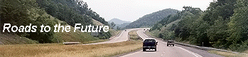
Roads to the Future photo articles
Pepperdine University
- 3 photos overlooking Pacific Ocean
Pacific
Coast Highway - 5 photos
I-10
Santa Monica Freeway - 3 photos
I-5 Golden
State Freeway - 2 photos
I-210
Foothill Freeway - 4 photos
I-10 San
Bernardino Freeway - 1 photo
CA-110
Harbor Freeway - 2 photos of the downtown
I-105 Glenn
Anderson Freeway (Century Freeway) -
5 photos
US-101
Ventura Freeway - 2 photos
The photos are in the 30K to 55K size range.
Much more California highway information is here --
California Highways
by Daniel P. Faigin.
Copyright © 2000 by Scott Kozel. All rights reserved. Reproduction, reuse, or distribution without permission is prohibited.
By Scott M. Kozel, Roads to the Future
(Created
3-31-2000)